
Le Morne Trail Preview
A map view centered on the Le Morne Brabant hiking start point, with one-tap links to open it in Google Maps or start directions.
- Map marker
- Le Morne Brabant Hiking
- Coordinates
- -20.46002, 57.32731
- Map view
- Interactive
- Use for
- Trailhead
What Is Le Morne Brabant?
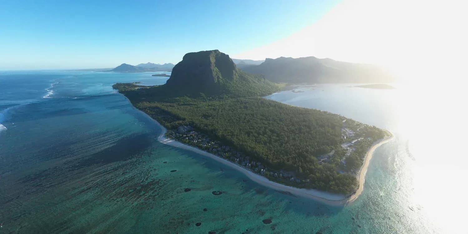
Le Morne Brabant is the dramatic basalt mountain at the southwest tip of Mauritius. It rises above a lagoon, beaches, village life, and one of the island's most important cultural landscapes.
For many visitors it first appears as a beautiful hike or viewpoint. For Mauritius, it is far more serious: a place tied to slavery, maroonage, oral traditions, resistance, and the memory of people who searched for freedom in a hard and exposed landscape.
Why It Matters
UNESCO recognizes Le Morne as a cultural landscape because the mountain was used as a refuge by people escaping slavery during the eighteenth and early nineteenth centuries. Its cliffs, wooded slopes, caves, shelters, and difficult access helped make it a place of resistance.
The site is not only the mountain summit. Its meaning extends into the foothills, coastline, village memory, and surrounding lagoon. Hiking, history, ecology, geology, culture, and visitor responsibility all belong together here.
How To Use This Site
Start with the hiking guide if you are planning a climb. Start with the history and UNESCO pages if you want to understand why the mountain is sacred. Use the nature and geology pages to go deeper than a normal travel blog.
Every page is designed to answer a specific visitor question, cite official sources where needed, and guide people toward safe, respectful choices.
Frequently Asked Questions
Is Le Morne Brabant the same as Le Morne Cultural Landscape?
Le Morne Brabant is the mountain and peninsula people usually refer to. Le Morne Cultural Landscape is the UNESCO World Heritage property and its wider cultural setting.
Why is Le Morne famous?
It is famous for its dramatic lagoon views and for its deep cultural significance as a symbol of maroon resistance, suffering, sacrifice, and freedom.
Planning the hike?
Read the practical trail guide before you choose how far to hike and how to plan registered-guide access for Section 2.