Le Morne Trail Preview
A map view centered on the Le Morne Brabant hiking start point, with one-tap links to open it in Google Maps or start directions.
- Map marker
- Le Morne Brabant Hiking
- Coordinates
- -20.46002, 57.32731
- Map view
- Interactive
- Use for
- Trailhead
The Simple Answer
Le Morne Brabant is one of the most memorable hikes in Mauritius, but it should not be treated like a casual beach walk. The lower trail is easier and more scenic. The upper section changes character and includes steep, exposed, rocky terrain.
At the moment, Section 2 from Viewpoint 2 to the metal cross is accessible only through registered guides. Treat Viewpoint 2 as the decision point: without registered-guide access, the responsible plan is to stop there and return the same way.
Section 1: Trailhead To Viewpoint 2
Section 1 runs from the trailhead through Viewpoint 1, the first mountain plateau, to Viewpoint 2, the second plateau. It covers 2.53 km and rises from about 1.5 m to 260 m.
This part is still a mountain trail. Wet conditions, cliff edges, heat, and loose ground can matter, but it is the more approachable part of the hike.
Section 2: Viewpoint 2 To The Metal Cross
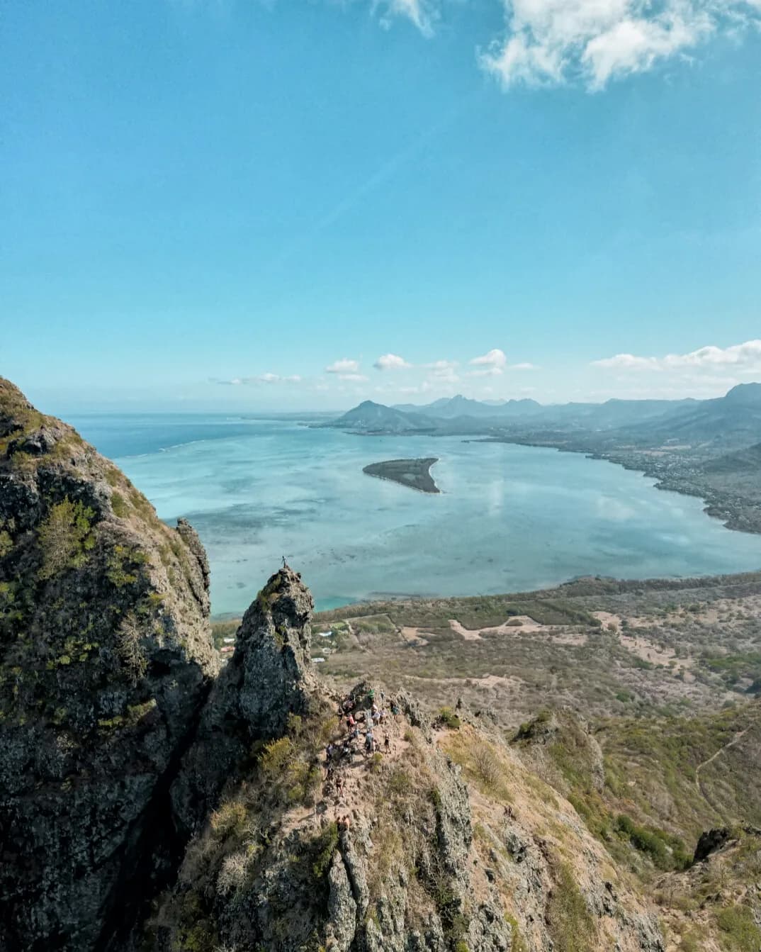
Section 2 is shorter at 760 m, but it is the serious part of the mountain. It starts at Viewpoint 2 and climbs through a gulley that becomes a natural waterway in rainfall, with loose boulders and rocks collecting in the same line of travel.
Expect a narrow Grade 3 trail, roughly 80 cm to 1.5 m wide, rising from about 260 m to 492 m. The terrain includes steep rock, ravine sections, hands-on scrambling, loose rocks, rockfall risk, wet-condition slip risk, strong wind exposure, and no vehicle access in case of emergency.
At the moment, this upper part is accessible only through registered guides. A liability form is required at the trailhead of Section 2, and the guide should assess weather, group ability, pacing, and whether continuing is appropriate that day.
- Use a registered guide for Section 2.
- Do not continue in rainfall or strong wind.
- Do not go beyond the metal cross.
- Give priority to hikers coming uphill on narrow exposed sections.
- Keep distance from other hikers in the upper section.
What To Bring
Bring athletic shoes with grip, enough drinking water, sun protection, a cap, light food, and clothing that can handle heat and exposed wind. Avoid sandals or casual shoes, especially if you are considering the upper section.
If you are going with a guide, ask before the day about weather, official access, meeting point, parking, and whether the full upper section is appropriate for your group.
Frequently Asked Questions
Do I need a guide for Le Morne Brabant?
At the moment, Section 2 from Viewpoint 2 to the metal cross is accessible only through registered guides. The lower section is the realistic self-guided option when conditions and official access allow it.
Can children hike Le Morne Brabant?
Children under 13 should avoid Section 2. Families should treat Section 1 and the viewpoints as the more realistic option unless advised otherwise by a registered guide.
Want the safest version of the hike?
A local guide can help with pacing, weather judgment, the upper section, and the heritage context that makes the mountain more than a viewpoint.